

Harrisonburg Gravel Routes
Ride the roads less traveled and find some spectacular places.
Adding gravel and dirt roads to your riding will open your cycling to a whole new world! Becoming comfortable with dynamic terrain breaks down any walls to new and glorious areas that pavement-only riding may have been preventing you from experiencing.
Click on either the Strava or Ride with GPS Route buttons to see the whole route, be able to download the route file, and print a cue sheet!
(Strava and Ride with GPS memberships are free if you don’t have one of these accounts yet. We like these platforms for route sharing the most - they’re accurate, easy to download, and easy to explore!)


Morning Gravel
16.7 Miles / 1,231’ Elevation


Typical Morning Ride
23.5 Miles / 1,758’ Elevation


Thursday Gravel
30.7 Miles / 2,697’ Elevation

2018 Harris-Roubaix
32.1 Miles / 2,817’ Elevation


John Kline Gravel
38.9 Miles / 3,600’ Elevation


Slate Hill
42.7 Miles / 3,381’ Elevation

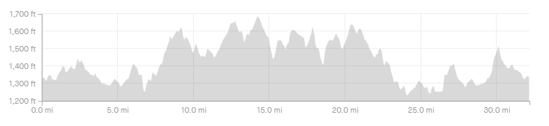
Reddish Knob Gravel
52.1 Miles / 6,836’ Elevation


Sounding Knob
50.2 Miles / 7,749’ Elevation
Don’t let the shorter distance fool you, the climb to the Sounding Knob Fire tower is quite the challenge, but worth it!

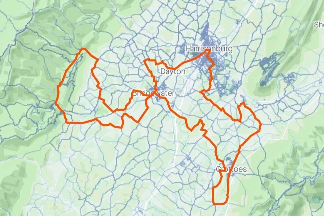
Height Hollow / Troxel Gap / Old Parkersburg
58.9 Miles / 5,884’ Elevation


Some Lexington, VA Gravel
72.9 Miles / 8,108’ Elevation
Awesome gravel climbs and descents in rural Virginia.


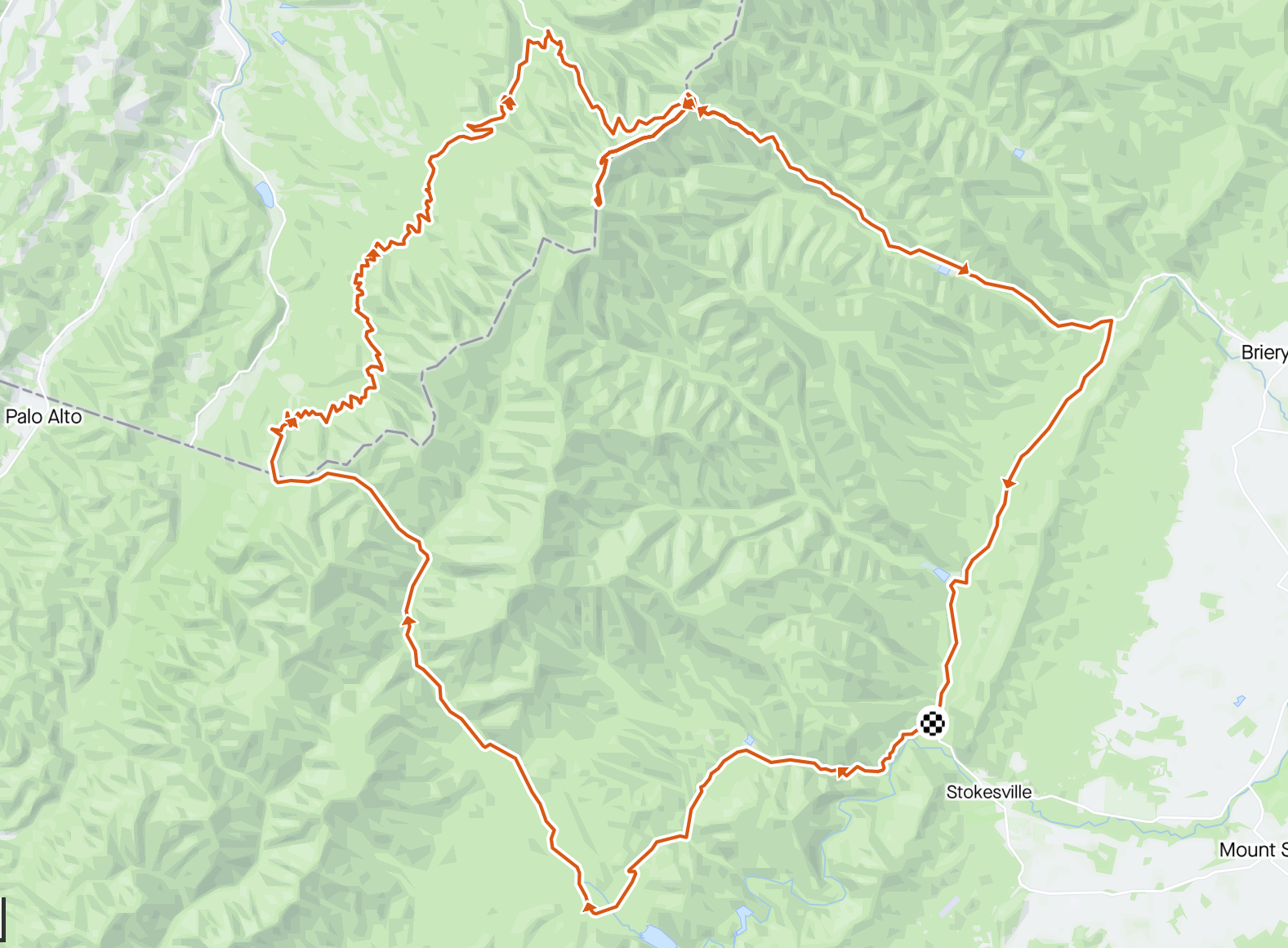
Augusta Triangle
60.9 Miles / 4142’ Elevation


Afton & Wintergreen
64.9 Miles / 8055’ Elevation


Cub Run
75.0 Miles / 7779’ Elevation

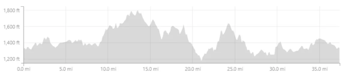
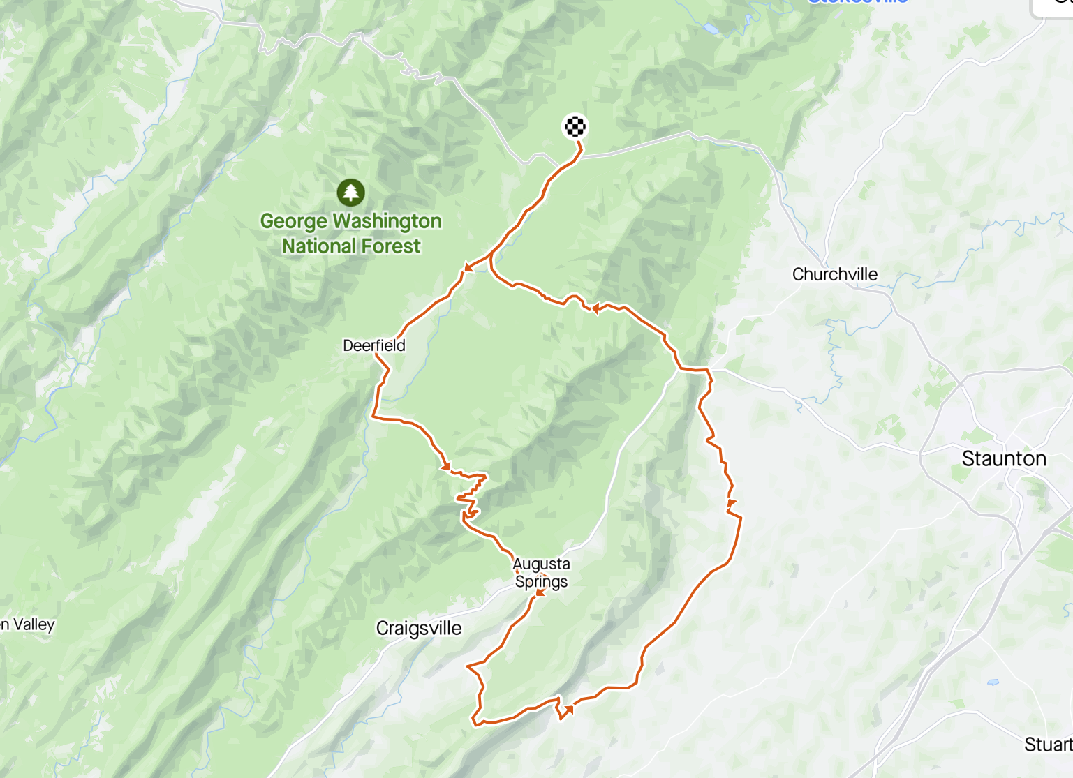
Orkney Springs - gravel
75.5 Miles / 6591’ Elevation
Supinlick Ridge Road will not disappoint!


East Side of Massanutten
85.8 Miles / 8869’ Elevation


Old Parkersburg!
80 Miles / 5,184’ Elevation
Leisurely Century
100.25 Miles / 5,698’ Elevation
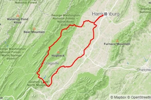

Goshen Pass
129.5 Miles / 7,891’ Elevation


The Big Spruce
145.8 Miles / 15,554’ Elevation