

Harrisonburg Mountain Bike Trails
Have fun out on our local trails!
To download other maps/use your smart phone, check out the TRAILFORKS or the MTB Project apps.
Also, not shown in our routes, but definitely should be checked out - Massanutten Western Slope! These trails are a 15-20minute drive away from Harrisonburg, and feature some of our best riding! Visit the Shenandoah Valley Bicycle Coalition’s website to learn more, purchase a pass (these trails are on private property), and have a lot of fun!
Click on the “Bike Route” button for each route to get the full info/cue sheet/download.
(Strava memberships are free if you don’t have an account yet. We like this platform for route sharing the most - it’s accurate, easy to download, and easy to explore!)


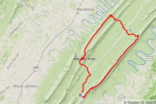
Signal Knob
8.1 Miles / 1,812’ Elevation


Narrowback
12.1 Miles / 1,719’ Elevation


Short Mountain
12.6 Miles / 1,805’ Elevation

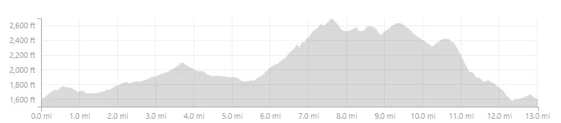
Lookout Mountain
13.0 Miles / 2,102’ Elevation


Up Wolf Ridge / Down Hearthstone
13.0 Miles / 2,522’ Elevation


Mud Pond + an Extra Loop on Blueberry
14.7 Miles / 2,692’ Elevation


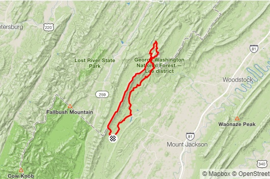
Big Hollow / Hone Quarry Ridge / Cliff
15.5 Miles / 3,215’ Elevation


Road / Bridge / Braleys
17.7 Miles / 2,371’ Elevation


Up Reddish, Down Timber/Wolf
19.0 Miles / 3,326’ Elevation


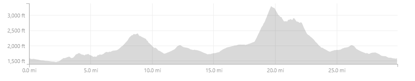
Horse Trough / Chestnut / Hankey / Lookout
28.1 Miles / 5,298’ Elevation


End-ish of SM100
27.1 Miles / 4,089’ Elevation

Beginning of SM100
29.91 Miles / 3,673’ Elevation

The Two Towers (Massanutten Gnar)
31.3 Miles / 5,282’ Elevation


Climb, Climb, Climb
33.5 Miles / 5,962’ Elevation


Death Star / Pond Knob
36.9 Miles / 6,633’ Elevation

Great North Mountain
39.1 Miles / 5,838’ Elevation


Middle of SM100
40.0 Miles / 5,324’ Elevation


SVBC Super Bowl Sunday Ride
50.7 Miles / 5292’ Elevation


Georgia Camp / SMT / Road Hollow
53.3 Miles / 5,829’ Elevation